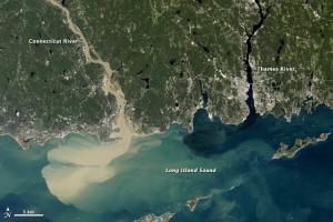
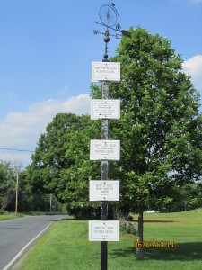
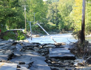
Images: Left – NASA Satellite image taken 9/2/2011 showing sediment plume. Center – Historic flood levels in MA. Right – Flood damage in Vermont.
On August 28, 2011 Tropical Storm Irene hit the New England region and caused significant damage and flooding in the Connecticut River Watershed. As the storm moved northward along the river valley, each state faced unique issues and weather-related concerns.
In Connecticut, coastal regions experienced flooding and storm surge along the Long Island Sound. Vast power outages plagued the state, in some cases lasting longer than a week. The damage in Massachusetts was primarily concentrated in the northwest region of the state. Heavy rains and high winds resulted in extensive flooding and downed trees. At least five tributaries of the Connecticut River in MA reached 100 year flood stage or above.
Vermont experienced the worst damage with extensive flooding and road washouts. A number of historic covered bridges were damaged, destroyed, or washed away. Many towns in rural regions of the state were left isolated when major roads and highways were closed due to downed trees, damaged bridges, and washed out roads.
In spite of significant damage to the region, flood control dams were credited with preventing even more widespread damage and loss of life. A U.S. Army Corps of Engineers report estimates that flood control dams prevented more than $30 million in damages across the state during Irene. Some estimates state that flood damage could have been as much as ten times more severe without flood control dams in place.
To read more visit:
Years After Construction VT Flood Dams Show Worth
Vermont Public Radio: Evaluating the State of Vermont’s Dams


